
Beaches
Where to swim in Kasos (full coverage)
Kasos coastline is stretched in about 60 kilometers; however most of the island’s beaches are steep and rock-strewn, hence not accessible by land. The above info applies mainly to the southern and eastern part of Kasos that is drenched by the crystal clear and deep waters of the Libyan Sea. This particular side of the island also houses several sea caverns, which are visitable by boat and one can easily to get to.
Generally, one in Kasos can find all types of beaches: from rocky to sandy beaches, accessible-only by sailboat either by car or others you can hike to, deserted shores, with or without infrastructure (sun beds, umbrellas, showers) to even exotic beaches such as the sand of Marmara beach in the neighboring islet of Armathia that is accessible only by boat and is defined by a tropical and Cycladic landscape as well as it has been voted one of the best beaches in the Mediterranean Sea. Finally, it is rather fascinating, the fact that even in high season (aka August), you may find lounging on the beach by yourself.
From the northeast towards the southwest, Kasos’ beaches are the ones below: Emporios, Vlicha, Kofteri, «BlueLagoon», Katarti, Ammoua, Agios Konstantinos beach, the shoreline in Antiperatos, Trita beach, Avlaki, Hohlakia, Helatros, Ompata beach, Troutsoula beach, Agali beach, Plaka beach, Thira beach, Limni beach, Hrampa beach, Akti, Framos, and one more – though an unknown stretch of sand.
Emporios beach
Emporios beach (about 500 meters east of Fry) was the seaport of the village Poli (the ancient capital of Kasos) during the past, whereas in recent times it used as the previous boat dock of Kasos. This is the most popular beach of the island since its small sandy beach, which is surrounded by tamarisks and offers shallow waters and a see-through sandy bottom, is attracting most of the visitors - mostly families with children. On top of that, Emporios is organized with tourist facilities (from changing rooms to sun beds and umbrellas) and also one there a series of taverns and cafes next to it, not to mention that is easily accessible on foot from Fry. Last but not least, if you stroll about 60 meters east, you can find a petite (30-40 meter long) shore – a naturalist back of the 70s & 80s – that is utterly protected from the adjacent rocks, to take a dip away from prying eyes.
Vlicha beach
Vlicha beach is a small, tranquil, pebble beach to be found also in Fry, approximately 300 meters from the main port. Being unorganized without a hint of tourist infrastructure, it's ideal for a quick swim, especially addressed to those who don't want to move away from the island’s center. Nearby the beach, you can spot the Municipal Library of Nikolaos G. Mavris. The beach is accessible on foot.
Kofteri beach
Kofteri beach is located in Fry and took its name because its shore was covered with stones in the past. This is a small shingle beach with pebbled seabed, with a few umbrellas and sun beds for lounge. This is another ideal beach for a quick swim in the island's capital. Apart from the above, on this particular beach the tournament known as "Mike Mastrandreas Cup" is taking place every summer paying homage to the native Michael Mastrandreas, who served as president of the European Volleyball Confederation and vice president of the International Volleyball Federation.
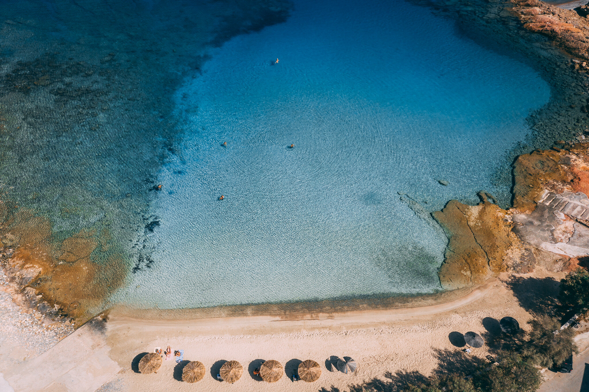
«Blue Lagoon»
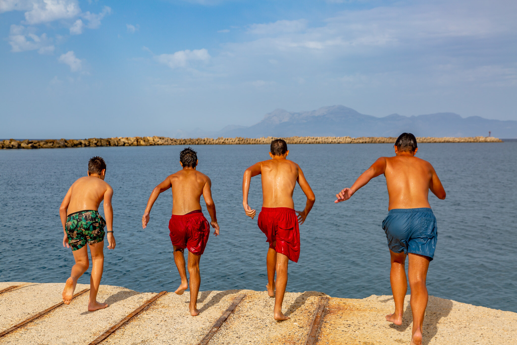
This is not a regular beach (basically it’s the foreshore between the sea and the land) an official geo name, but rather a native beach tag for a very small beach of many color in its tranquil waters (due to the breakwaters of the Kassiot harbor). The beach was ‘established’ in the 20s - when the locals threw at this very point sand to get rid of the rocks on the seafront - and bears a stretch of coastline with crystal clear turquoise waters as well as a bunch of sun umbrellas for the tourists. Lastly, the Blue Lagoon is favored among the youngsters who love diving in the sea from the surrounding cliffs. It is easily reached on foot from Fry, since it’s literally just a breath away from the island’s main harbor (Bouka).
Katarti beach
Katarti beach, which is located closeby Kasos airport, is the perfect combination of sand, fine pebbles and steep seaside rocks, while its shallow pebble seabed gets sandy after just a few meters swim. This is an unorganized, 100-150 meters long beach that is also easily accessible, an short drive from the main village of Kasos.
Ammoua beach
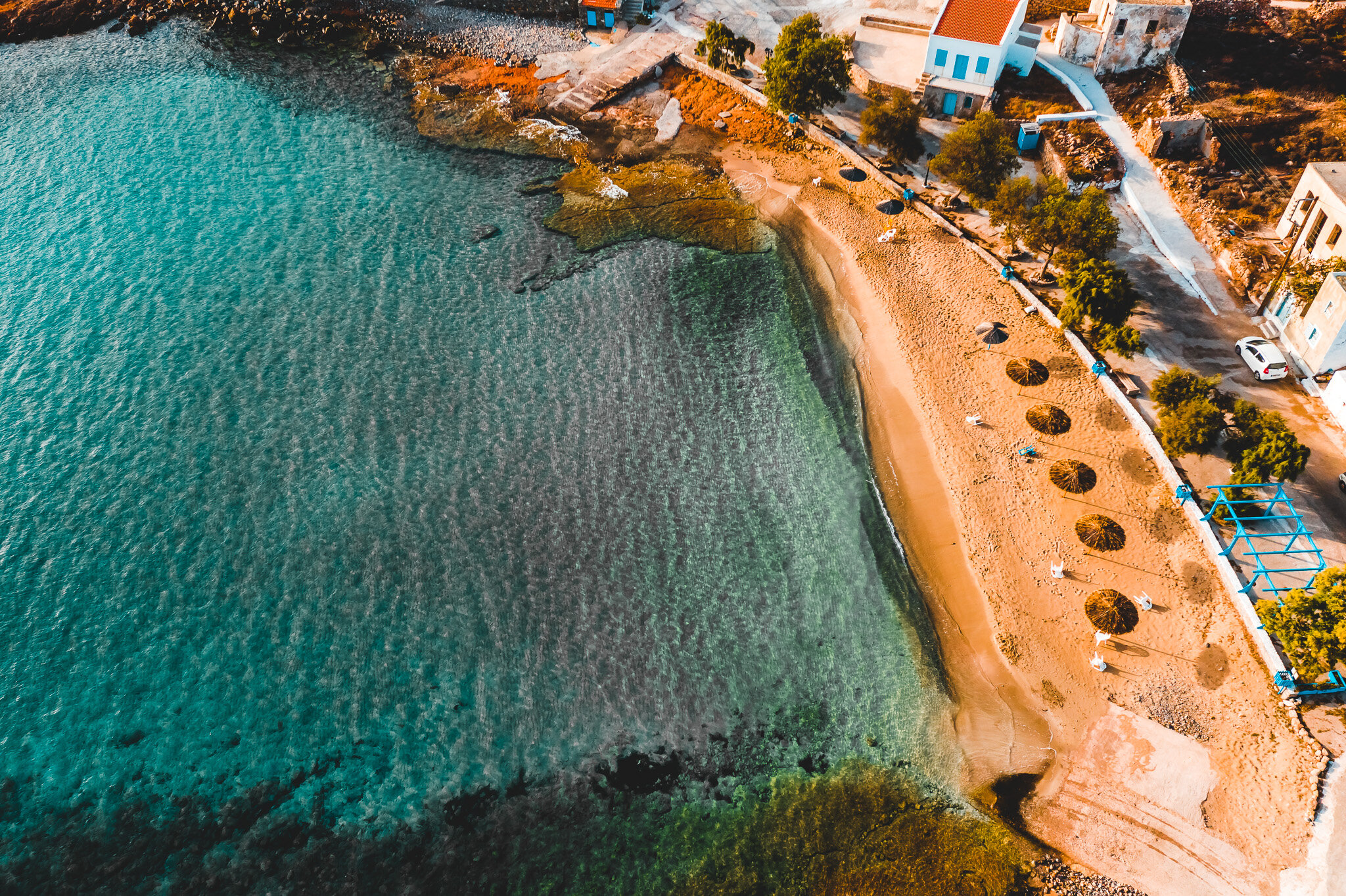
Ammoua – owns its name to its sandy bed, commonlessness in Kasos - is the second merely beach of the island that is covered in sand, after Emporios beach, and is situated about 4 kilometers west of Fry. Here, the coastline is composed of fine, golden sand, edgy rocks around and crystal clear turquoise waters with a sandy seabed. At Ammoua beach one can find modern sun beds and umbrellas, changing spaces, bio toilets, and a beach volley ground. Apart from these, on the beach is laying a café/resto offering from coffees and small tidbits to Greek mezes. Next to Ammoua beach stands the church of St. Konstantinos with some jaw-dropping sunset views of the Aegean Sea.
Agios Konstantinos beach
Agios Konstantinos beach is an ‘under-construction’ shore (since 2018), designed for the furry friends of locals and visitors alike. This is a rather small beach of 20-25 meters long with pebbles and large-grained sand.
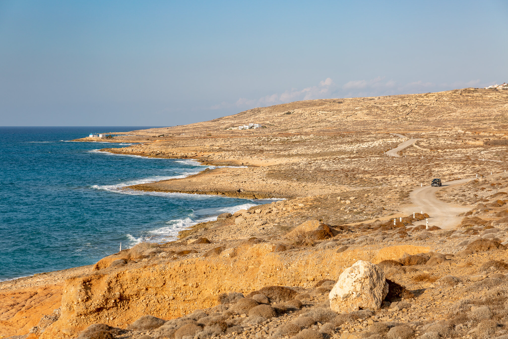
Antiperatos beaches
The shoreline of Antiperatos houses 5 adjacent beaches of fine pebbles and large-grained sand with a range of colors, rocky seabed with crystal clear waters, and yet they are exposed to the north winds of the ocean hence displaying great sea swell and often large waves. Each of these beaches is accessible on foot from the main road and positioned just below the renowned monument that is dedicated to the Holocaust of Kasos - approximately 5 kilometers away from Fry. This shoreline constitutes the wildest, however easily accessible side of the island, and is regarded ideal for snorkeling, surfing, and diving far away from the madding crowds. Between the 3rd and the 4th beach, one can find sea clay.
Trita
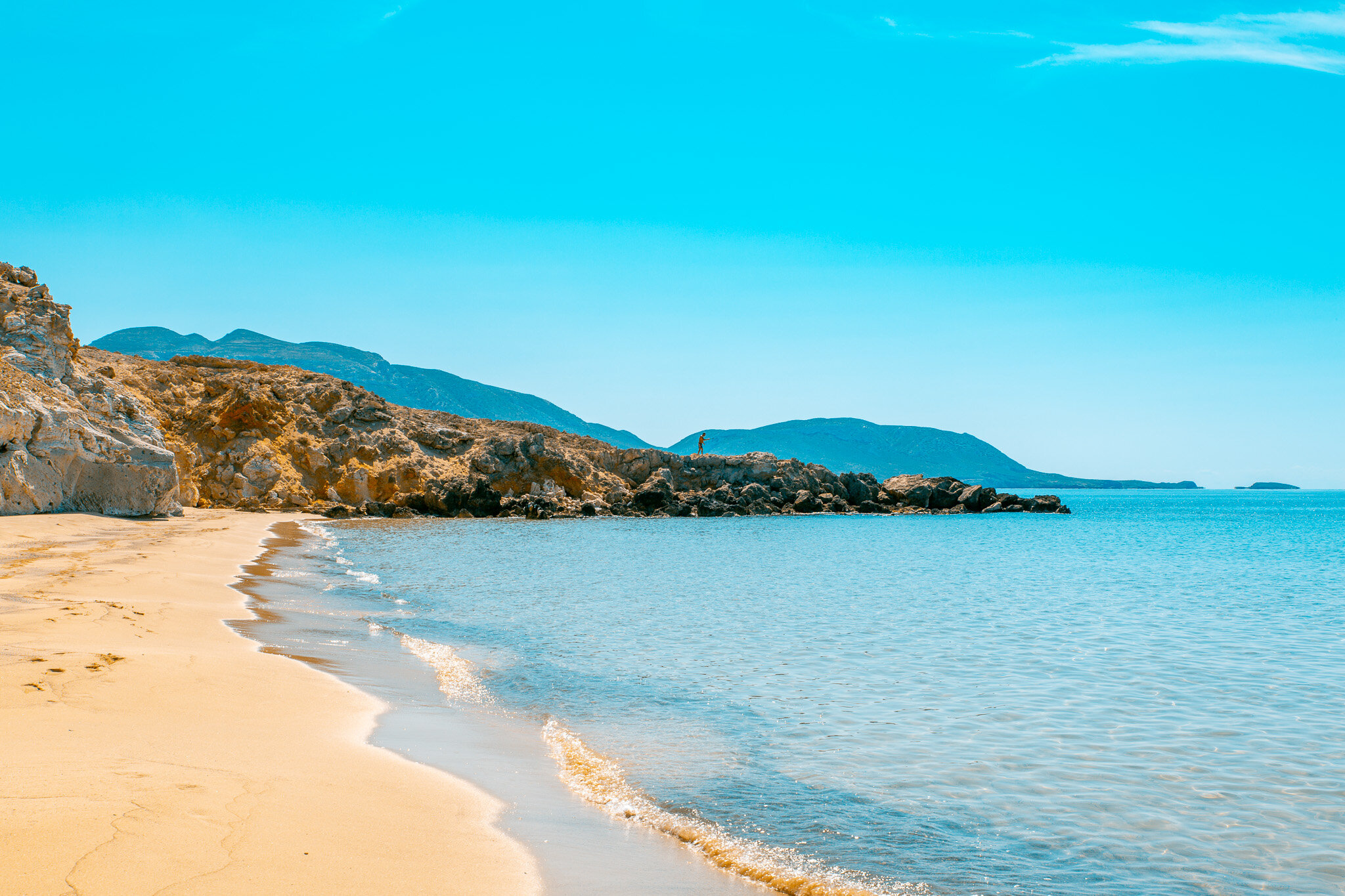
Trita Beach (known also as Tripiti) is believed to be one of the top beaches in Kasos and its name derived from the fact that there is a rocky formation amidst the sea - about 70 meters from the coast. The beach is normally exposed to strong winds, yet it offers a fine and large-grained pebble shore that has also a pebbled seabed, hence it is an ideal destination for lone swimmers, nudists and all kind of adventurers. Mind that one has to carry with him/her any beach supplies for a long distance and rather strenuous hike. Trita beach is accessible after a 3.5 kilometers hike from the church of Agios St. George in Hadies – also consider the route has a lot of ups and downs following the riverbed and is regarded as a difficult path. Nevertheless, the beauty of the remoteness of the beach and the total absence of tourist facilities at last compensates every visitor. Finally, the beach is as well accessible by boat, and offers many excellent spots choice for snorkeling.
Avlaki beach
Avlaki beach (or Vathi Avlaki) is placed within a calm bay on the southwestern tip of Kasos, a site that used to be a mooring for boats some time ago. This shingle beach that is protected from the north winds, no matter if the weather is blustered against the sea, characterized by its crystal clear blue waters and a pebbled seabed. Avlaki beach is accessible by boat or a 60-minutes walk from the church of St. George in Hadies. On another note, as the hike starts from a high point, one is rewarded with far-reaching views of the sea throughout the trail. Finally, this is not an organized beach and thus it is highly recommended to have with you the very basics (i.e.: water, a good pair of sneakers for the downhill as well as a summer hat for the scorching sun). The beach is totally recommended for sole swimmers or nudists alike. In case you find yourself swimming a bit outside of this cove, you will encounter a series of rocky formation (of approximately 80-100 meters height) that shape underwater ravines - ideal for underwater explorations.
Hohlakia beach
Hohlakia beach is a small stretch of sand in the southwest of Kasos and is adjoining Avlaki beach, and thus is reachable in the same way: by boat or taking the trail that starts from the church of St. George in Hadies and goes all the way down to the beach, (a 60 minutes hike, in total). It is an unorganized shingle beach with quite thick stones, pebble seabed and of course, crystal clear waters. In case you get there by hopping on a boat, you can as well indulge in exploring the chambers of a nearby cave-gorge.
Helatros
Helatros is the most off-the-beaten track beach of Kasos (about 14 kilometers from Fry) and is located on a cove in the southwestern part of the island, which remains up until today deserted. Thanks to a series of adjoining rock formations, Helatros beach remains untouched by the weather conditions and the rage of the northern winds. As a matter of fact, once upon a time it served as a safe refuge for the Minoan ships. Nowadays the beach constitutes a mix of fine pebbles and thick stoned surrounding the shoreline, as well as a pebbled seabed with clear sparkling waters facing Libya Sea – an ideal spot for every snorkel. Just away from the beach and right on the front of this ancient bay, there are strong currents and swell waves, creating the perfect conditions for any surf enthusiasts. Along the coast one can find sun umbrellas and cozy loungers, as well as there is a seasonl canteen – operating during high season – that serves from coffees & snacks, to grilled fresh fish, which you can enjoy under a handmade hut with a few sitting tables. The beach of Helatros also features the bust of Eleftherios Venizelos. This was the last part of Greece that the prominent politician from Crete visited before leaving for Paris in 1935, after an attempted coup against him.
Ompata beach
Ompata beach is a long pebble shore in the southern part of the island. A sequence of contiguous rocks provides protection on the sea and additionally offers - at all times - serenity to the beach that is accessible only by sailboat.
Troutsoula beach
Troutsoula beach is a haven for the fishermen (also known as Fantasy beach for the local shepherds). This small seashore is sited on the southern tip of Kasos and is characterized by some rock formations that are rising around its coast. Troutsoula beach is only accessed by boat.
Αgali beach
Agali beach is a pebble stretch of sand with thin-grained sandstones and comprises of an elongated shoreline with crystal clear waters, in which one can even see his/her reflection on its seabed. This beach is located in the southern part of Kasos (right in the middle of the island) and is accessible only by boat. As a result of the masses of rock above the beach and the native goats climbing up and down them, the area is described by the locals as the "Porto Katsiki of Kasos".
Plaka beach
The forsaken Plaka beach is also an elongated pebble beach in the south of the island, besides being barren by the track of land. All the surrounding rocks protect the coastline from the strong winds, making it ideal for a swim when the northern winds get roughened. Lastly, Plaka beach is accessible only by sailboat.
Thira beach
Thira beach is a long, pebble shore that is looking towards Egypt. It is accessible only by boat, and is regarded as one of the secret beaches on the southern part of Kasos, distinguished for its steep cliffs offering the much-needed protection from the strong winds of the vicinity.
Limni beach
Limni beach (or else Karpatholimnionas or Apolimni for the natives) shares exactly the same features like the previous shores. In other words it is an ‘extension’ of the southern coastline of Kasos, known for its tranquility. This elongated shrine beach with the fine pebbles is only reached by sailboat.
Hrampa beach
Hrampa beach is also formed by rocky cliffs and / or by precipitated parts or dry waterways of the island and is a short shrine stretch of sand with fine pebbles located on the south tip of Kasos. Hrampa beach is accessible only by boat.
Akti
Akti beach is found in the east and overlooks cape Kastellos as well as the regional airport of Karpathos. This is a small elongated pebble that approached only by boat, however one should diligently move towards the beach due to its proximity with the passage between Kasos and Karpathos and also is characterized by scores of current flows. However, approximately 1,5 km away from Akti one can find a reef with a sank small 15-20 years boat, hence the spot is pitch-perfect for diving.
Framos
Framos beach is a tiny unorganized pebble beach that was shaped around 1994 at the mouth of the homonymous - dried out - river. It is accessible by boat or by car (after walking for about 500 meters across the riverbed).
Unknown beach
It is one of the most undersized and an unknown coastline of Kasos. A pebble beach about 10 meters long, with deep steep waters surrounded by rock formations and caverns, in which actually the Mediterranean seal is breed and live. This unidentified beach is accessible only by sailboat and obviously deserted.
Marmara beach
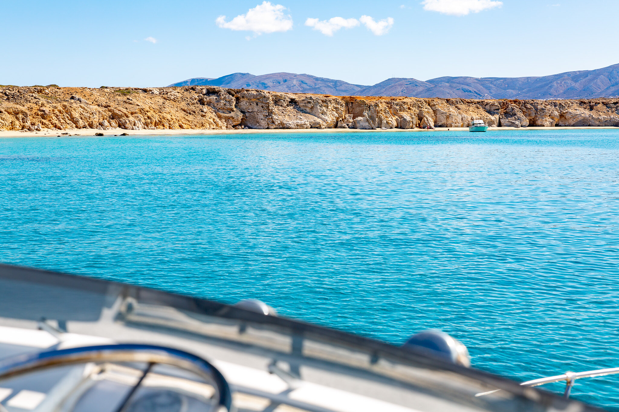
Marmara beach is located on the abandoned isle of Armathia, north of Kasos, and is undeniably one of the most impressive beaches in the region. Distinguished for its fine pearly sand (which in reality is a blend of white Mediterranean sand with marble dust), a soft sand seabed as well as a rather peculiar combination of tropical blue water tones - perhaps due to the white gypsum under the island's soil - is not a coincidence that is believed to be one of the best beaches in Greece The postcard-perfect Marmara beach is about 2.5 kilometers long and doesn’t have any tourist infrastructure, so beware to bring along your beach necessities. Marmara beach is easily accessible by the regional sailboat that runs daily from the main port of Kasos during high season (if bad weather does not prevent it), an approximately 30 minutes trip time (namely 3.5 nautical miles).
Karavostasi
Karavostasi beach - named after its previous use as a ship port - is the second beach in the islet of Armathia, and has crystal clear waters (yet is not consideres as exotic as Marmara beach) and its sand is a mixture of mineral and Mediterranean gypsum. Not so long time ago, this was an island full of life and gypsum was being exported from Armathia abroad. As a matter of fact, on the northern end of the coast, one can see up to this day the leftovers of railroad tracks, which were leading to one of the island's gypsum mines, reminiscences of another era.
Apopantoula
Apopantoula beach is a very small beach also attached to the islet of Armathia and is positioned inside a tiny marina, under the chapel of Ypapanti, from which it took its name. Apopantoula is accessible on foot from Marmara beach and basically addressed to those who want to take a sole dip in rather odd island beach or even stroll around the locale. Although this is another unorganized beach, the spot is just right to set safely an anchor, with an overall draught of 1.5-1.8 meters.
Makra beaches
On the neighboring islet of Makra there are 9 beaches in total. On the northern side of the island one can spot 6 adjacent beaches of different sizes, of which the dark colored sand resembling the black beaches of Santorini, whilst on the windiest southern part of Makra, there are 3 more stretches of sand.
